Syracuse Orange College Checks

NHL and Buffalo Sabres Checks

Cheap Syracuse Bank Checks


Golden Snowball Totals for the 2010 - 2011 Snowfall Season
Updated  5/1/2011

GSB Cities This Season Normal Average
to Date
This Time Last Season Normal
 Seasons Average
All Time Season Snowfall Record
Syracuse 179.0 111.8 106.1 121.1 192.1 inches
( 1992 - 1993 )
Rochester 127.0 99.8 89.8 100.3 161.7 inches
( 1959 - 1960 )
Binghamton 117.5 80.8 81.4 81 134.0 inches
( 1995 - 1996 )
Buffalo 111.8 96.7 74.1 97 199.4 inches
( 1976 - 1977 )
Albany 87.2 62.6 45.4 62.6 112.5 inches
( 1970 - 1971 )

Order Cheap Personal Checks Online

Deals on Bowling Balls, Bowling Bags and Bowling Accessories

Monday, December 31, 2007

Winter Classic Forecast

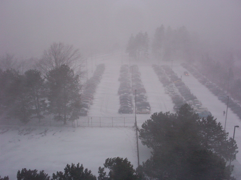
Well not a whole lot of interesting news as far as the contest goes. Some on and off snow and lake effect shaping up this week with an artic outbreak. But even this won't last to long as we look to get back into the warm then cold then warm again cycle. Syracuse looks to hold and pad their lead even more, Rochester should hold strong at #2, but the bottom three cities could really get into a close race as Bingo and Albany look to pick up some additional snowfall and creep up on Buffalo. At least a few cities are staying competitive and not running up the score! ANYWAYS.....

You may have, or may not have heard that come New Years Day the first outdoor NHL game is going to be played in the United States. The Buffalo Sabres will face off against the Pittsburg Penguins, and hopefully the Sabres can break their 3 game losing streak. Well that and I hope they can play a bit more exciting of a game. One of the most high powered offenses in the league that can score 4-6 goals per game on a regular basis, has been held to just 2 goals in the last 3 games. Not to mention even the other teams didn't play that exciting of a game.


A Quick Plug to the NBC promo....


Another interesting aspect of this game is how quickly crews managed to convert a football field into an outdoor ice rink. Following the Bills last home game of the season on December 23, crews began working to get the rink and stadium ready to play a hockey in less then 9 days time. Trouble began early in the process as 50+mph winds began to blow away the traps on the field and a lake effect squall on the 24th temporarily haulted the preperations. However by late in the evening on the Christmas Eve crews finally got to work and since have been working through the night to get everything done. First they tarped the field, layed down plywood and foam padding to give an even surface for the 9 inch crown on the football field. The refrig unit was put in, followed by adding sand and gravel. The boards and glass were then added, then work to add an inch of ice went on. The ice had to be painted white, another 1/2 inch of ice was made, logos were added and a final 1/4- 1/2 inch of ice was layed down. Then work on the benches and other fine tuning went into work. While it sounds rather simple it's actually quite a bit of work to be done in such a short time. Crews said that after the short delay on the 23rd and 24th the weather since has been perfect, with little wind, temps in the low 30's during the day and high 20's at night, and even a shot of rain which came right as they were making the ice surface which they said actually helped to speed up the process of making the rink. Here is a time lapse video of 5 days of work, the 23rd - 28th, condensed into a 74 second video.


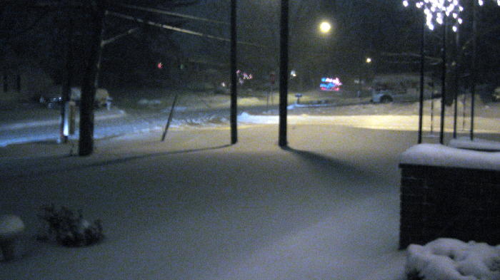
Now I haven't heard if this rumor is true or not yet, but it has been said that due to the "lack of expected snowfall" the NHL was having snow shipped into the stadium to add t the decor they were going for. Well if it is ture... I guess the NHL should have waited a bit longer for their snow. Tonight were seeing a nice... light... snow across the whole region which should drop a fresh 2-3 inches by morning. Then things look to get interesting heading towards game day. A few days ago the models had a system moving in with rain changing to lake effect snow for the game. Now the models are snowing an all snow (with a short mix late Monday night), and the chance for a heavy burst of snow right towards the end of the game, but maybe later on. Either way it looks to at least be lightly snowing for the the entire game New Years Day. The NHL was hoping to see a "touch of snow falling", they will get that but maybe a bit more then they asked for. The game will occur in a rather short window of time 1pm until probably no later then 330 - 4pm, so if the heavier burst of snow is gonna wreck havoc it has it's time to do so. Otherwise were looking at temps in the upper 20's (which are perfect for the game), and winds slowing picking up to 15-20 mph, ( a bit higher then ideal, but no where near chaotic for the game). So we shall wait and see when finally happens weather wise for the game. Regardless it should be a great event for the area, and if you've got nothing to do New Years Day, tune into the Winter Classic or the "Ice Bowl" as were all calling it here at 1pm, on NBC, CBC, RDS. You can also see the action LIVE online at NHL.TV or NHL.COM, with pregame coverage starting online live at 11am New Years Day.

Hopefully it's nice and snowy that day during the game to keep Buffalo's rep of being the SNOWY city, even if Syracuse beats us in the contest every dang year!


If I'm not back on before everyone have a HAPPY and SAFE NEW YEAR!

Remember.. DON'T DRINK AND DRIVE! CALL A CAB, OR SPEND THE NIGHT!

Saturday, December 29, 2007

Daughters Art Work - Favorite Christmas Gift

Ok, there still isn't much yet to talk about weather wise so I figure I'll tick off my daughter Danielle by posting some of her art work on here. Just don't tell her because she is modest unlike her dad and gets embarrassed easily also unlike her dad :0) Some of her drawings and oil paintings are from when she attended East Syracuse Minoa high school and a couple of newer ones from 2 years at Herkimer college and this year while attending Suny Oswego. This is her first year of really learning and getting into oil paints and the oil painting of the pond at Oswego was one of her Christmas gifts to me because when I saw it on parents weekend she knew I loved it. Of course I'm a little bias and being the proud dad I am I love all of her art work. Of course pictures taken from a camera of art pieces never do them justice.

I've been working on her the last year or so to come up with a painting or drawing that has something to do with our Golden Snowball contest to no avail YET. I'll keep working on her though :) I was thinking of maybe something like a snowball fight between the Mayors fighting for the trophy with the trophy in the midle of them. Any other suggestions?

What was your favorite Christmas gift this year???


Just Click on The Pictures for a Larger View


My Christmas Present - A scene from Suny Oswego


Self Portrait Several Years Ago


Another of My Favorites


A New Oil Painting


Danielles Softball Uniform and Gear


Have a Great Weekend All!!!

Friday, December 28, 2007

A Nice Little Break

Well I'm almost all rested up from the Christmas holiday. Hopefully everyone had a fantastic Christmas! A well needed break from the computer. It will still be a hit and miss for me until after the new year but I'm sure the General with have something to say with some snow in the forecast for the near future. There really hasn't been a whole lot to talk about other than a lot of rain which made the traveling season a lot easier for most people I'm sure. I got my white Christmas but it was pretty close to being green with all the rain that fell.

I was surprised to hear my nieces boyfriend who came in from the Albany area say that the roads were slick yesterday morning around the Herkimer, Utica area. Sure enough Albany is reporting just over an inch of new snowfall for yesterday along with Binghamton showing half an inch so it looks like the east and south of the state made out. Albany has been a big surprise so far this season with the amount of snow they have received this early in the snow season. They are less than 2 inches away from being half way to their totals for the whole season last year. It will be interesting to see if they can keep it up or not.

All the cities continue to blow away last years totals and even Buffalo has past their totals for this time of the year from last season and most likely that will be the trend for the rest of the snowy season. If I remember correctly last year at this time we were in a rut that lasted up until about the 9Th or 10Th of January when the snow really started coming down. The next week or so looks like some snow with a possibility of some decent snowfall right around the beginning of the new year on January first. All the stats are up to date now with no major changes. Have a great day everyone!

Monday, December 24, 2007

Have a Merry Christmas Everyone

Have a Merry Christmas everyone and a heartfelt Merry Christmas to those who won't be home with their families this Christmas!


OK, lighten up Snowman


For the younger visitors (I liked it too)


I would love to see the looks on my neighbors faces if I could do this :)


Happy Holidays!!!

Labels:

Friday, December 21, 2007

Another Interesting Weekend!

Before I start, I hear a lot of people say "isn't a werid the big storms always happen leading into or on the weekends or holidays". I don't know what your stance is on that, but come Sunday into the Christmas Eve holiday the weather sure does look to get interesting.

Too many events to list together so I'll break it down...

1. Temperature Swings and Flood Threat - By midday sunday many areas will be looking at temperatures in the mid 50's to as high as 60. Could get close to record warmth with the Southerly sloping winds. The temps won't last long with a possible 30-35 degree droup in just a matter of hours by late evening. With the high temps and a possible 1/2 - 1 inch of rain during the afternoon the snowpack should quickly melt down to nothing and creeks may get close to action stages in some areas. No threats of ice jams or major long term flooding, but some do need to be monitored.

2. Severe Thunderstorms for X-Mas???? - not overally likely, but have heard some mention that ahead of the cold front their is a chance a small area of strong to severe thunderstorms could pop up with damaging straight line winds. The SPC has noted the chance but isn't giving it much attention. Just another thing to keep your eyes on Sunday.

3. High Wind Potential - escpially for the higher terrain and finger lakes region winds could be in the 45-60+ gust range. Nothing suprising with the high winds this time of year, hope your lights are anchored onto the house good!

4. LAKE EFFECT - Cold+Wind = GOOD! Buffalo is finally under the lake effect gun for the first time this season. As usual the narrow cone of uncertainty could drop anywhere over the Buffalo area. Could be just to the north, right over the metro, just to the south, who knows. Even a chance if the winds are too strong they may prevent intensification of a lake band over Buffalo, and could actually send a plume of snow as far inland as Rochester. Regardless of where the band sets up or stays the most, the whole WNY should see a fresh coat of lake effect just in time for Christmas!


So how is everyone's snowpack holding in so far?

Wednesday, December 19, 2007

All is Quiet in Winter Wonderland

There isn't a whole lot to talk about plus Wednesday is always my day off, sort of so I thought I would just pop in let you know there is a fun sports contest going on right now but the deadline is tomorrow. Below is the info that Sre and Weatherman left in the forum for anyone that wants to play around. It's free and the prizes are the same as we give away here. A pat on the back for winning something :)

I'm not sure what time the deadline is though. Maybe Sre will let us know. Obviously before the first game starts :)

From SRE and WEATHERMAN - In The Clutch, a sports message board - forum, is proud to bring to the Golden Snowball members a bowl competition. Go to this form page to enter http://intheclutch.x10hosting.com/ncaafbowl.htm . Choose the team you think will win each game and assign a unique confidence value, from 1 to 32, for each pick. Maximize your points by assigning your most confident picks to the highest confidence values. With each correct pick, you will earn the points put to the respective game. The first bowl game is on December 20th, so you have just under a day to make your picks.

You do not need to be an ITC member to be a part of the competition, though only ITC members will be able to change their picks by posting on that message board...and if you like this competition, feel free to join In The Clutch, where there are many more available.

Enjoy the bowl games, and the snow!

Tuesday, December 18, 2007

Will it be a White Christmas

In 3 words, it better be! The topic just came up in by Evan aka - wxduff in the forum who is studying in meteorology at Suny Oswego this year. WeatherT says it looks right now that it will be warming up by the end of the weekend and we will probably see rain come Sunday. 3 more words NO, NO, NO. Last Christmas was green and it %$^$&^. Not two Christmas's in a row I hope.

Tony (WeatherT) left some hope for us though mentioning that behind the storm that brings in the rain will be cold air that should HOPEFULLY start up the lake machines and bring some bright white fluffy stuff to the Golden Snowball cities on Christmas eve. Lets hope it all pans out. I've been trying to find some stats on the odds of having a white Christmas for all the cities but so far I have only found Binghamton and Syracuse's stats. I'll post the others when I find them and maybe the General knows where they are and will post them in the mean time.

So far December has been a fun and white month for all of the cities. Most likely it won't be a record setting month but a couple of cities may end up having a snowy December that ends up in their top 5 snowiest Decembers ever. More to come on that later but right now Syracuse and Rochester are approaching their top 5 numbers.

The odds of a white Christmas and snowfall in Syracuse on Christmas Day - Stats provided by NOAA and are the average from between 1949 - 2004

63% Chance of have an inch or more of snow on the ground.

37% chance of getting an inch or more of snowfall on Christmas Day.

68% chance of at least getting a trace of snow on Christmas Day.

The odds of a white Christmas for Binghamton according to NOAA


64% of Christmas days have an inch or more of snow on the ground.

18% chance of getting an inch or more of snowfall on Christmas Day.

53% chance of at least getting a trace of snow on Christmas Day.

The Odds of Buffalo having snow on the ground Christmas Day ( All I could find for now)

57% chance of at least an inch on the ground

23% chance of 5 inches on the ground

13% chance of 10 inches of snow on the ground Christmas day.

The Odds of Binghamton having snow on the ground Christmas Day ( All I could find for now)

60% of an inch on the ground

23% of 5 inches

3% of 10 inches of snow on the ground Christmas Day

The Odds of Albany having snow on the ground Christmas Day ( Hard to believe :)

63% Chance of an inch on the ground Christmas Day

30% chance of 5 inches on the ground

13% chance of ten inches of snow on the ground Christmas day.

For some reason I have a hard time accepting Albany's stats for Christmas snow. I'll look around and see if I can come up with some more stats for Albany, Buffalo and Rochester about it actually snowing on Christmas day.

With that all said look for the Golden Snowball snowman to be a little hit and miss the next several days. The reason being I don't have a thing done yet for Christmas and I am running out of time quickly. Have a super day all!

From The General

Pat you always beat me to the punch on these threads. I was getting all my stuff ready to put up a White Christmas thread, and guess what I see on the main page! Anyhow...

Looks to start warming up a bit heading into the weekend, maybe another inch or two to add to the snowpack tonight across the state with a weak clipper.

Storm heading up into the central great lakes will bring up some decent rainfall on Saturday into Sunday, hopefully it won't be enough to destroy the snowpack but could put the chances of a white christmas in jeporday.

The lake effect certainly will get cranking up on Sunday night through Tuesday. Alot depends on where the system exactly tracks and how slow it is to turn to the eastward track. Looks like it might fire up some quick limited lake effect on a SW flow to get some snow into Buffalo, then shift to the W during Christmas Eve and eventually turn into a NW flow going into and through Christmas Day. I really want to see how the NAM plays out this storm when it picks it up in the next 36-48 hours. It handled this past storm the best of any of them.

Chances:

Albany: 50% depends on how well the snowpack can hold with the rain.

Bingo: 60%again with the snowpack holding, but should see at least some flurries on Christmas Day.

Buffalo: 75% snowpack should hold and a chance of even some weak lake effect would make it a sure win.

Rochester: 85% snowpack should definitely hold, and Christmas Day lake effect will help out again.

Syracuse: 98% just cant give any city a 100% chance... just in case.

12/18/07 3:34 PM

Labels:

Monday, December 17, 2007

It's Going to Be Close Race

Evening Update - Just a quick update to add the new totals for the Guesstimate game we played. These totals are the last of the updates and came out between 4:30 and 6:00 pm for all of the cities. The stats are both a combo of the storm totals and any lake effect that fell between the 15th and the 17th at about 6 pm give or take. I'll do some adding tomorrow and figure out who was the All Star Meteorologist of the last few days.

Milestones that were reached in the last few days are Syracuse hits the 4 foot mark, Rochester hit the 3 foot mark, Buffalo and Binghamton hit the 2 foot mark and Albany hits the 1 foot mark.

Syracuse - 16.2
Buffalo - 12.9
Rochester - 11.6
Albany - 8.7
Binghamton - 4.5

Daytime Update - Take a look at the new totals for the Golden Snowball cities. Buffalo sledded into 3 rd place bumping Binghamton down next to Albany. One thing I noticed yesterday was that all the cities for the first time this season I believe are over their yearly average snowfall. You can count on this seasons contest being a good one and right now the trophy is up for grabs.

If you feel like this season (I say season because it's not even winter yet) seems to be long already compared to last year? Your right! Just look at the stats for this time of the year last year. They are being blow away. Syracuse and Rochester have almost 3 foot more of snow than they did last season. Binghamton is close to a couple of feet more and Albany is about a foot and a half over last years totals. Buffalo is under but remember they had the freak October storm and just them catching up to those totals is impressive. Syracuse almost has half of their annual snowfall already needing only another foot or so. Rochester has over a third of their annual snowfall and the other already have more than 1/4 of the annual totals.


More snow stats came in for yesterday and I feel a little bit better. Not about my predictions as to how much snow all the cities would be getting but about shoveling yesterday and last night. I'm glad that it was more than 5 - 6 inches that was kicking my butt. Buffalo remains in the lead for our little guesstimate game that we played. We set the timeline until 6 pm tonight which by then NOAA should have all the stats up to date. Here is what the cities have received according to NOAA with Buffalo and Rochester's last update reported around 4:30 am. Syracuse, Rochester and Albany's stats were updated around 1:00 am give or take a little so figure Buffalo and Rochester have 3 hour more of snow that was reported. Confusing? I'm confusing myself. It comes down to all the weather stations don't report at the same time, enough said :) The totals so far for the 15 Th - 16 Th with probably a little LES thrown in:

Buffalo - 12.4
Syracuse - 11.7
Albany - 8.6
Rochester - 8.3
Binghamton - 3.4


Here are a few snow pictures from yesterday just outside Syracuse.


Have a Great week everyone!


Labels: ,

Sunday, December 16, 2007

Was the Snow Storm a Bust?

Nightly Update (6:00pm) - Well the stats just came in for what has fallen so far and I think we can officially say it was a BIG BUST according to the numbers I just updated above. More snow is still in the forecast though so I suppose we'll have to wait it out.

I'm not going to whine, nope it's not going to happen. All I will say is that had to be the hardest 6 inches I have ever shoveled and the worse thing is I'm not done yet. That's all that is being reported for the Syracuse area so far if my math is right and I wouldn't count on it. The line up has changed but remember it is still snowing and come tomorrow there might be another change. Sorry Binghamton, Buffalo bumped you down a notch right next to Albany :)

I know I said I wouldn't whine about the stats that were reported but I will ask one question :) Do the people measuring know not to measure the snow next to an airplane with the engine running??? I'm kidding, we appreciate what you do.

Buffalo is winning this round so far with Syracuse 2nd, Albany 3rd, Rochester 4th and Bingo on the bottom but come morning that will most likely change a little.

Here are the snowfall totals so far for the BIG BUST of the December 15 -16 Snow (cough) Storm as of 4 - 5 pm Sunday:

Buffalo - 7.8
Syracuse - 6
Rochester - 5.6
Albany - 5.1
Binghamton - 2.4

As for the snow guesstimates. So far some of us would have been closer to the totals if we guessed 0.0 on all the cities, lol :) Of course a couple are pretty close. It's not over though and maybe another 20 inches will fall over night, not!

Anyways it's still snowing and I'll double check the stats either later tonight or tomorrow and also add what falls tonight.....


Morning Update - Maybe not! Round two is getting ready and cranking up. It's a mess in the Syracuse area and where I live which is just outside the city and most likely hazardous driving all around most parts of NY so don't drive if you can avoid it.

Here in the Syracuse area we hopefully made a permanent change over from sleet to snow. Probably close to an inch of sleet give or take a little just fell in a matter of an hour or so. That's a lot of sleet for that short period of time. Totals as far as snow goes from the overnight aren't in yet but the chances are they won't be too impressive because of the mix that most of us got. I took a look at some preliminary stats and I was surprised at who had how much and who didn't. At my house there is probably about 5 - 6 inches so far and that is counting what is coming down now. I'm not so confident though as to if I was figuring out the stats I was looking at right so I won't post anything yet. When the later day stats come out for some of the cities from NOAA I'll post the official stats. From what I saw was that Albany seemed to do pretty good but then again it could have been rain, mix and snow. These were stats I'm not use to looking at. Enough said for now because like I said I could be reading the data completely wrong :)

OK, round two most likely will be better than round one was so keep an eye on your local forecasts. The professional ones that is. We just guess here and pretend to know what we are talking about and most of you probably already know that by now :) You can check out the current warnings for all of NY at http://www.weather.gov/view/prodsByState.php?state=ny&prodtype=warnings . Their the pros when it comes to forecasting. Look for a later day update and have a safe Sunday all.

Saturday, December 15, 2007

It's a Go, It's Gonna Snow

First off, I have to once again take my hat off to Mike Murphy from Binghamton for calling this storm before anyone else did. I just looked it up and he mentioned this storm way back on Decmeber 7th only missing by a day saying the 17th. Great call Mike :) https://www.blogger.com/comment.g?blogID=1269336486158113204&postID=5349093145198662425

Unless something freaky happens get ready to get pounded by the white fluffy gold from the sky. Most likely all of the Golden Snowball city's will have something to talk about tomorrow and Monday as the snow storm is expected to move in later tonight. The western cities, Buffalo and Rochester might end up having the bragging rights to this storm but I'm not as convinced as I was yesterday about Rochester winning this round.

I think it's going to be a close one and it only takes a little shift one way or another to change everything. The temperatures above are also going to play a part in this storm. Most forecasts are calling for it to start of as snow and then change over in some places to freezing rain or sleet for a while and then back to snow. Whoever can hold onto the cold air the longest most likely will win this round. The North country most likely will see the most snow and I am seeing forecasts of up to 30 inches for them. The general consensus seems to be 12 inches or more by the time this storm passes by for most of the GSB cities. I'm guessing there will be some changes in the lineup come Monday and it will be interesting to see if Buffalo can bump Binghamton down to 4Th place and more interesting to see if Syracuse can hold onto it's narrow lead of 5 1/2 inches in the 2007 -2008 Golden Snowball race. Let's try the guesstimate game here on the blog.

The snow guesstimate game is just a matter of picking the totals snowfall that you think the cities will get and how they will all place. The winner gets, ummm, bragging rights for calling this one right??? You can just post your totals in the comments. Lets include some LES and say snow total chenges from now until Monday night at 6PM. I'll post mine a little bit later. After the storm passes :) I'm kidding! Later this afternoon. Try to make your guesstimates by lets say 7PM and if you happen to stop by a little late, who cares. Post em, it's not like there is a prize or anything :)

Rochester - 23
Syracuse - 21
Buffalo - 16
Binghamton - 13
Albany - 11

Remember, SNOW MEANS SLOW!!! SEE SNOW DRIVE SLOW!!! Stay off the roads when this storm hits everyone. It just isn't worth it and if you don't have to drive, dont't.

Friday, December 14, 2007

Blizzard This Weekend?

I hate to hype up a storm anymore then it deserves...

awwww who am I kidding I love to hype storms!!!!


But in all serious-ness the approaching storm is really starting to look like a potentially super strong winter storm. A lot still rest on what the storm will do but the models have now begun to shift this from a true coastal nor'easter to more of a super strong low system skirting up the interior northeast. Before I start talking about the maybes I will mention again we must wait and see if the models are coming into an agreement on the new track of the storm or if they are just seesawing in uncertainty.

YET... if the current models hold true the worst weather would be found in an area from Buffalo to Syracuse with the possibility of 1-2 plus feet. Another factor with the new track to consider is the wind speed. If the track holds true and the low can still deepen enough over land, it is VERY POSSIBLE all of WNY and CNY could experience or be be placed under Blizzard Warnings for most of Sunday.

Still a lot remains unclear and I think we will start to get a better picture of the storm tomorrow into Saturday morning. Regardless should be an interesting weekend. I'll be back tomorrow with a better forecast of what I think is going to go down.

Thursday, December 13, 2007

It Snowed in All of New York

Today was just a little preview or call it a teaser as to what's to come this weekend MAYBE. Most likely someone will be getting pounded come the end of this coming weekend and right now it is just a matter of who and where. Of course that can always change as the weekend draws closer so keep an eye on your local weather channels and news stations.

As for today It looks like it's time to break out the shovels in Buffalo, Syracuse, Rochester, Binghamton. Albany might want to hold off another couple of hours because it's still snowing there. It will be interesting to see how the line up looks for the GSB city's come tomorrow. So far only Albany, Buffalo and Rochester have reported some stats.

I'll do an update on what's being reported for Syracuse and Binghamton once the stats roll in from NOAA. My guess is that Binghamton and Albany may end up winning this round. It's a matter of which city Binghamton or Albany comes out on top for the day.

(Edited) - to add All cities up to date now as of 5:00 give or take a little.

Reported so far for December 13Th;

Binghamton - 5.7 (Record for the date)
Buffalo - 4.4
Rochester - 4.2
Albany - 3.5 (it's still snowing there)
Syracuse - 3.3 (Losers)


It is slick out there on the roads so TAKE IT SLOW DRIVING!

Wednesday, December 12, 2007

Interesting Weather Ahead!

The cold winter pattern looks to keep hanging in for us for at least the next week and bring with it some rather interesting weather. Several general snow systems, throw in a possible costal whooper, and some lake effect in between those to keep us occupied!

I am starting to get a little concerned with Buffalo falling so far behind so early this year. Since we usually get about half of our snow from the lake machine, one rooting for Buffalo should be worried since the lake is already down to 38 degrees (2 degrees below normal). If this cold continues Erie should start the icing over process by the end of December. Still leaves a chance for Buffalo to get back into things, but we better start kicking into gear and quick. Hopefully we will have that chance come Friday when a band might get fired up right into Buffalo, just have to wait and see.

As far as the other cities go, Bingo might be looking at a nice addition to its total Thrusday-Friday when a general snow storm tracks across Southern NY, and they might make a run for 1st or 2nd place. Then if Buffalo can get in on some decent lake effect, we might have all four cities neck and neck again.

We get a quick break from the snow early Saturday, but then a huge system moving in very early Sunday could turn into a major nor'easter and drop even more snow for some places. Hey maybe Albany can finally start posting some snowfall numbers.


I leave on this note....

Tuesday, December 11, 2007

Winner of the Free Live Santa Phone Call

The drawing was just held for the Free phone call from Santa. The names were written down on a piece of paper and the name was drawn by the Snowman's Mom to make it as fair as possible. OK, enough of the suspense.

The winner is Mike Trask from Phoenix, NY who I just talked to on the telephone and he has a couple of children that hopefully will be excited when Santa Claus gives a call to their house.

Also A quick thanks to SantaSpeaking.com for giving us that free certificate. Maybe we can do something like this in the future but with a little more time for more people to enter. Mike, let us know how the call goes if you have a chance.

I'm hearing some reports about a possible Nor Easter that might happen towards the end of this weekend. I have to give the thumbs up to Mike Murphy who mentioned this a couple of days ago in the comments section. It's not a certainty but something to keep an eye on weather wise in the next few days. Have a great day all!

Labels:

Monday, December 10, 2007

What is Meme Blogging?

We have our first entry in our win a free phone call from Santa contest. Thank God at least one person has entered other wise I might have had to given it to the General and he doesn't sound too happy with Santa right now due to last year. Hmmm, makes me wonder if the General may have found a little bit of coal in his stocking last year???

Being on the computer almost 24/7 I like to think I am up to date on most of the current fads online. Not this time though after reading NYCO's Blog. She posted a great meme and it has to do with snow questions.

What's a meme? From reading around it appears to be where one blogger will post some questions for their visitors to answer and then other bloggers will post the same questions or answers on their own blog linking to the blog that they first found the questions at. I THINK! Anyways I really like the questions that the nyco came up with on her blog at http://www.twentyfour01.com/nyco/ and I want to play the game also :) So here are the questions from NYCO for you to answer:

1. What’s the winter tool you can’t do without?

2. The winter tool you could do without (i.e., find unnecessary or silly)?

3. Your favorite music to listen to when stuck in the house in a snowstorm?

4. The winter sound you least like to hear?

5. Your driveway shoveling pattern: vertical (up and down)? horizontal (pushing from side to side)? Or any which way?


My answers are;

1. One of the lightest and cheapest plastic snow shovels I have which probably cost less than $5.00 several years back. The kids aren’t allowed to use it. They get the heavier expensive shovels I have :)

2. A snow brush. My coat sleeves and the cheap plastic shovel seem to do a better job.

3. I love all kinds of music but most likely during a snow storm it’s whatever music the weather channel is playing for the weather on the 8’s.

4. Like Sean, the snow plow slamming down the blades and the reverse alarm. Normally about 4:00 am like clockwork.

5. A path from the garage door to the end of the cars and then down the middle and side to side. My real favorite patterns are my kids which means they are in town and I don't have to shovel )

Ellen feel free to chime in if I am playing the game wrong :)

Have a fantastic week all!

Labels: ,

Sunday, December 9, 2007

Win a Live Phone Call from Santa Claus

Win a FREE phone call from Santa. Yup, The snowman is playing Santa's helper this season. The North Pole called me up yesterday and said Santa needs a break and wants to give a little child a phone call. They offered me a free phone call from the real Santa Claus. I thought I would offer it up here because unfortunately we no longer have any little ones who believe like I do that there really is a Santa Claus. Two little ones on the way though to start off the next generation of snow lovers :)

We will have a random drawing on Tuesday afternoon if more than one person emails. So lets set the deadline to enter at Tuesday, December 11Th at 12:00 PM. It's really that simple. After the drawing all emails will be deleted and we will only contact the winning parent. The winner will receive a free call from Santa to one child which normally costs $21.95. Hey long distance phone calls aren't cheap from the North Pole ya know. The call on average lasts about 3 - 5 minutes and is personalized thanks to the help you give Santa online. You can add extra stuff like a recording of the conversation but your on your own for that at your cost. This offer is just for the call to one child and none of the extras. You can find more information about the calls from Santa Claus at http://www.letters-from-santa.info/ .


If parents, aunts, uncles or grandparents are interested in winning a free phone call from Santa all you have to do is email Santa's Helper at santashelper@goldensnowball.com with your name, city, state and email address that you want us to contact you at. Also please put ENTER SANTA DRAWING in the subject line to make sure I notice it. I receive thousands of emails a day. Remember, This is all just a fun little contest and Good Luck to everyone.


THE RULES!!!

None really other than you must be an adult and a phone call will be made just to verify it.
Must live in the US.
Must love snow! (not really though, I'm kidding of course)
Entry Email must be received by 12:00 pm EST, Tuesday December 11Th. (we will email you back just letting you know that we received your entry).

Disclaimer:

We are not responsible for any emails that do not reach us. As mentioned above we will email you back just letting you know that we received your entry.

The snowman at Golden Snowball IS NOT responsible for anything else as normal and any questions can be mailed to santashelper@goldensnowball.com . This is all in good fun and Good Luck!

Now where was all this stuff when I was growing up. Don't worry we never went without no matter what the circumstances were. To this day and since before I was even born Santa has always like clock work showed up at our house on Christmas eve and even with all the non believers now I'm expecting he will show up this Christmas eve also. You can also order letters from Santa and live phone calls if you would like to at http://www.letters-from-santa.info/

Drive slow and keep an eye on your local weather because there may be a mixture of a little snow and freezing rain on it's way. Enough said and have a great Sunday all!

Labels: , ,

Saturday, December 8, 2007

All's Quiet in the Golden Snowball City's

Only a few tenths of an inch here and there and all the stats are up to date. It's a mix of clouds and sun here in the Syracuse area. I'm still impressed with the snowfall stats for this season compared to last seasons.

A couple of things that stand out is one that Rochester and Syracuse are almost 20 inches over their totals for this time of the year last year and that Buffalo is over 20 inches behind last seasons totals. Binghamton and Albany are also both ahead of last years total snowfall. What's it all mean??? Beats me but I find it pretty interesting!

Another thing that caught my eye is that here we are at the beginning of December and Syracuse has already received 25% of it's average yearly snowfall. This snow season is kind of starting off like the 2002 - 2003 season in which Syracuse received 40 inches in December with the season ending total of 153.2 inches. Of course the snow season after that 2003 - 2004 was similar and that year Syracuse received 181.3 inches. Whats this all mean??? Beats me :)

Rochester which had only 2.2 inches this time of the year last year is at 21.7 as of today and they already have over 20% of their seasonal snowfall on the ground. Binghamton is already over a foot of snow and although Buffalo is a bit behind their normal average my money is on them catching up in no time. It only takes one good storm to change things around. Have a great weekend all.

Wednesday, December 5, 2007

3 City Snowfall Records Broken

You have to wonder if three daily snowfall records being set yesterday is a sign of the snow season that lies ahead of us. Binghamton, Syracuse and Rochester all set the record for the most snowfall on the date for yesterday. Buffalo is just showing a trace of snow for yesterday which is totally mind boggling to me....

Binghamton probably got a little short changed on the snow stats but still managed to break the daily snow total that went back to 1972 picking up 2.4 inches. Rochester broke the daily record for yesterday picking up 8.4 inches for yesterday blowing away the old record of 4.5 also set in 1972. Syracuse broke the old date record which went all the way back to 1950 also picking up 8.4 inches for yesterday.

A few people were wondering why Binghamtons totals were coming in so low including myself. Here is the explanation as to how it went according to a forum member who lives in the Bingo area. "A couple things happened. One was that the best lake band dropped into western and southern Broome county and missed the airport. The other was that the wind at the airport was blowing around 30 mph and kept blowing the lake fluff off the snowboards so the guys had to estimate". It all evens out though. Sometimes the airports will get more snow and other times they won't for most of the cities.

We have a long snowy season ahead of us and this is just the start of it. Looking at this years snow stats and comparing them with last years I'm starting to feel more and more confident about my winter predictions for this season http://goldensnowball.com/2007/11/oracles-golden-snowball-2007-2008.html . So far this season 2 city's Binghamton and Rochester are already over the one foot milestone and Syracuse is already over the two foot mark. Interesting start to say the least. Have a great day all!

Labels:

Tuesday, December 4, 2007

It's a Close Snow Contest

Evening Update - Well sort of what some of us expected has happened. A change in the line up with Buffalo dropping down to 4th place in the Golden Snowball contest. The biggest surprise to me was that Rochester was able to jump up to second place and bump Binghamton down to 3rd. I was watching the radar and it seemed like both Bingo and Rock City were getting a pretty good dumping on. Unfortunately Binghamton's numbers came up a few inches short. Way to go Rochester. Syracuse is approaching the 2 foot mark compared to last years stats of the 2 inch mark. Syracuse better watch their back! Have a great night all and some pictures posted at the Syracuse website proving it really does snow in the city of Syracuse and not just at the airport:

http://www.syracuse.com/photos/news/gallery.ssf?cgi-bin/view_gallery.cgi/syr/view_gallery.ata?g_id=5512

No updates since around 5 pm yesterday for Rochester or Buffalo so it will be really interesting to see how it looks once their new stats are posted. Syracuse, Binghamton and Albany stats were updated at around 1:00 am. Binghamton has got to be the surprise of the season so far and may have a shot this season for the fact that the snow bands have been going pretty far south and even setting up there. Mike posted that they were getting some shite out conditions late last night so they probably have a lot more to report come the later day update.

So far since yesterday and the numbers will change and the stats also aren't including the over night snowfall Syracuse still holds a small lead. If I were a betting man which I am I would be betting that the order is going to be changing with a possibility that Buffalo just might be bumped down to 4th place after reading around a bit. Of course snow is still falling so who knows, Syracuse might be bumped also. Ya never know! I'll post the stats today as they come in so look for a couple quick updates during the day. I think the next update for Buffalo and Rochester come out about 12:30 pm.

Hers is a picture that my daughter Danielle sent me from Oswego where she transferred to this year, her Junior year. Living in the Syracuse area she is use to all the snow but she is definitely not use to the wind that she has to deal with everyday up at Oswego. I know there is a lake there somewhere. She mentioned that she heard they actually tie ropes across the campus so you can hang on to them to get to class and not get blown away. The question is this true or as Tony from the forum puts it an Urban Legend???

Labels: ,

Monday, December 3, 2007

Good News and Bad News for Snow Haters

The good news for those of you who hate our snow is that most of the winter snow storm warnings are no longer in effect the GSB cities except maybe Albany. The storm system that came through and dropped all the freezing rain and plain old rain on most of us has expired.

The bad news for you snow haters is get out the shovels because lake effect snow warnings have been issued for some of the Golden Snowball cities. It looks like the Buffalo, Rochester, Syracuse and maybe the Binghamton area might be seeing a good dumping of the white gold over the next couple of days. Up to a foot or more in some places between Monday and Tuesday night most likely will be falling and to make things worse the winds are expected to be blowing the snow around pretty good. Keep an eye on the weather and your favorite forecasters and weather channels the next couple of days to keep updated as to what's going on. It's gonna get messy, no doubt about it.

What really bugs me, like anyone cares. What really bugs me is that we get 5 - 6 inches of snow that makes everything look beautiful, we end up shoveling it and then it rains wiping it all out. Now I knew rain was suppose to be coming but I figured if it was just freezing rain and I left the snow it would have been a PITA to shovel it afterwords. Anyways the grass was showing this morning after all that rain but come tomorrow morning I don't expect to see any of the still green earth showing.

It's time for an SU Basketball rant. Notice how I kept kind of quiet during the football season :) Believe me that wasn't easy but it's over with now. Here is my whine about the Syracuse basketball team and it's not directed at them at all. I watched the game the other night and it was probably their best defensive effort of the season. I seen SU bodies flying all over the place playing halfway decent defense. I start reading around the next day to see what was being said about the game and very little was good. The biggest reason I was reading around was trying to see why Paul Harris took a shot at Tulane's basket????? The only thing I read that might make sense is that he thought a foul was called????

Anyways I liked the way they played and everything I am reading is about them going 4 for 20 from the outside or whatever the stats were. Get over it people. Su is going to have off outside shooting days. The thing is that they had the shots. This team so far is one of the best offensive teams that I can remember in awhile. Sure the defense needs work. OK, the defense pretty much stinks right now but the other night it wasn't bad and it probably would have had the same effect on most of the Bg East teams we'll be playing soon. Most of these guys are freshmen this year and the way they are moving the ball on offense is in my opinion pretty remarkable. I'm loving the running game like we use to have in the past. I also like the leadership That Eric Devendorf is displaying this season. Even coach Boeheim doesn't give them enough credit when they do something right IMO of course.

And don't let Eric Devendorf's style on the court fool you. He has a puppy's heart in real life. He happened to pop into a fundraiser I attended over the summer which made a lot of people happy including my niece. She wanted an autograph from him and also a hug. She was too shy to ask so I mentioned it too him and with no hesitation gave her one. She still talks about that hug from Eric. Thanks Eric and Good Luck to all the players this season. I'm already enjoying it win or lose! OK, enough said! For now anyways.

Have a great week all and stay safe and take it easy driving!

Sunday, December 2, 2007

Drive Careful This Week

NIGHT UPDATE!

Just a quick update on the snow stats for today so far. Binghamton has managed to fend off Buffalo so far by just 0.3 of an inch. Rochester finally made some kind of move and so far is winning this storm event. Albany hasn't updated yet so it will be interesting to see if they got much or not. It's official that Syracuse has gone over the 1 foot of snow mark standing at 13.1 inches. The totals for this storm for today only are below and remember it isn't over with. More is expected over night.

Rochester -4.7
Buffalo - 3.8
Binghamton - 3.1
Syracuse - 1.7
Albany - No Report


It looks like all of the Golden Snowball city's are getting some snow and it looks to continue off and on for the next couple of days. Every kind of precipitation is in the forecast including snow, rain, freezing rain, cats and dogs, the kitchen sink and so on so if you have to go out take it slow because the weather is hit and miss right now and it can go downhill quickly.

Syracuse is unofficially over the 1 foot mark. Unofficially because NOAA hasn't posted the new stats from overnight but looking out the window it's more than a safe bet. I remember getting an email from Eric last season, a fellow Syracusan I believe. The email was sent in the middle of February stating how he remembers that in the first week or so in January of last season Syracuse was just over 12 inches of snow. By the end of December 2006 Syracuse had only 12.2 inches of snow and only 12.3 inches up until January 9th according to NOAA stats. Then on Jan 10th we got 10 inches. Here it is the 2nd of December 2007 and they are already over that. All the city's besides Buffalo of course because of the October storm are above last years totals but below the normal so far. IT'S a RACE and IT'S ON!!!

Lets just hope that the other cities can come in with some decent numbers and what's up with Rochester this season? They really need to get it going or they might be finding themselves at the bottom of the list and there is nothing more embarrassing than being below Albany. It's a real possibility depending on what Albany has gotten so far and gets the rest of today. Most of Syracuse's snow update was from the wee hours of Saturday morning and ended up with a total of 4.8 inches for yesterday. Buffalo picked up 1.5 inches of new snow, Rochester just under an inch reported so far, Bingo and Albany are both reporting .03 but most likely those totals will go up.

It's gonna be a good snow season I believe for the skiers and the sledders but the start seems pretty weird. In a matter of less than 48 hours I have cut the grass and shoveled the driveway. Something seems wrong, very wrong with that picture. Just give me my 50 degree day to get up the Christmas decorations and I'll be happy. Have a Super Sunday everyone and drive careful.

Saturday, December 1, 2007

Syracuse Slips Back into First

Syracuse has sledded into first once again but by less than an inch but after reading around it looks like about 5 inches of snow fell in the Syracuse area so the totals will be going up. Remeber we go by NOAA stats which are official and so far only 1.8 is being reported which was just after midnight. Once NOAA updates them later we'll post some new stats. A winter storm watch is in effect for most of NY from Sunday through Monday and you can read the Generals post about it at http://goldensnowball.com/2007/12/storm-early-next-week.html and here is a good picture of what Steve is talking about at http://radar.weather.gov/Conus/index_loop.php

I think this season will be remembered as one that had the most lead changes throughout the snow season by the time everything is done and over with and that's no time soon. So far we have had 4 leaders in the Golden Snowball contest with Buffalo kicking off the new season just like they did last year.

Syracuse is reporting 1.8 inches of new snow for yesterday and more fell over night. A few tenths of an inch for Bingo and Albany and thats about it for now. I woke up to the sound of the plows dropping to the road and as always had to get up and see what the Snow God had dropped on us while I was sleeping. I was a little surprised to see everything covered in white even though I saw a band coming our way last night right before I fell asleep. I wasn't surprised to see that my Neighbor Frank across the street already had his driveway shoveled. He normally is the first followed by Julie and then myself a week later when I decide it's not going to melt anytime soon. I'm kidding of course, I do shovel sooner. Frank is kind of the leader of the neighborhood in a sense that we all kind of keep an eye on what he is doing. If he puts his trash out we know it's trash pickup the next day. Every now and then though Frank goofs up and of course us being the followers that we are end up doing the same thing. Trash night here is on Tuesdays but but one time Frank mistakenly put his out on a Monday night and of course a couple of us followed :) Ok, enough rambling and back to snow.

Don't be surpised if Syracuse's lead doesn't last too long. Looking at the radars it looks like Buffalo and maybe Binghamton is getting some snow as I type. Plus read The Generals post below about a storm system moving in to all of the GSB cities. So far there have been 4 different leaders as mentioned and I'll try to keep track of that in the posts. Leaders and changes so far to date for the 2007 - 2008 snow season:

Buffalo
Syracuse
Binghamton
Syracuse

Have a great day all and get outside and play in the snow.

Storm??? Early Next Week?

Finally something somewhat interesting to talk about after a short disappearance from the main page blog. The forecast models are still having trouble with predicting the storm heading our way Sunday, but it looks likely all of us will see at least some snow from this storm. A lot depends on the track of this storm, where the snow/mix/rain line forms, how large of a snow shield pushes ahead of the low, and so on.

Bingo - looks to largely miss out on this storm, maybe a few flakes, but could see the most in the way of mixed precip.

Syracuse - close call as to how much snow can fall before the changeover. may not be the winners of the general system, but could pack on a few inches Monday-Wednesday when the lake effect gets fired up again.

Rochester - should see a good 2-3 inches of snow before the changeover takes places. might also be looking at some additional lake effect much like Syracuse.

Buffalo - seeing the snow first, if the timing is just right could be looking at 3-5 inches and maybe a heavy period of sleet before the changeover to rain takes place. really needs to add on some inches as the lake effect just isn't cutting it so far this year.

Albany - my upset winner of this storm. much depends on how quickly the cold air can filter in behind this storm, but i'll give them a storm total of 4-8 inches as they may seem additional snow from a smaller secondary storm following the main storm out to sea.

While any shift in the track could mean the difference between a foot of snow and 3 inches of plain old rain, this is the first major impact storm of the season for us. Hopefully everyone remembers how to drive in this stuff, and please... please... don't go out panic shopping for this dinky storm tomorrow. I hate it when the weather men call for a small storm and the stores get packed with paniced people out buying 5 gallons of milk, 10 loafs of bread, and a case of peanut butter to be ready.

Have a great weekend everyone, maybe we will continute to have an interesting race going on, and hopefully I'll be back soon with something more interesting to talk about!