Certainly an interesting weather day in the Great Lakes region. Several things to cover. I'll break them apart into four sections with the highlights in case you don't feel like reading everything.
1. Lake Ontario Snows - 50 inches in 24 hours!
2. Lake Erie Snows - Ice? Not a problem for Buffalo!
3. Hurricane Michigan? - What the heck is it?!
4. Lunar Eclipse update!
1. The tug hill got a pretty good plastering of lake effect, upwards of 50 inches reported in Pulaski in about a 24 hour period! That is just crazy! But then again what else would you expect in that area this time of year? Below is a link to the regional radar from the tug hill from 11pm Tuesday through 9am Wednesday. It is just amazing to watch that band dance back and forth across Oswego County like that!
http://www.weathermatrix.net/2008/0220/rp220osw-1.movHere is another link to a good closeup loop of the radar from the Pulaski area from 1130pm Tuesday through 930am Wednesday. No wonder they are reporting 50 inches with the looks of that band!
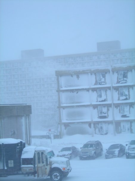
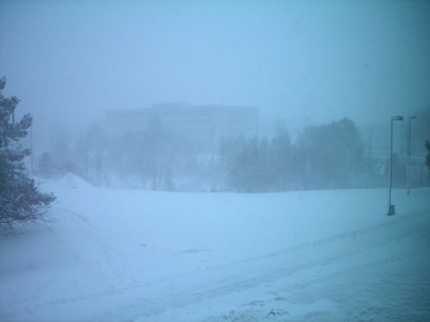
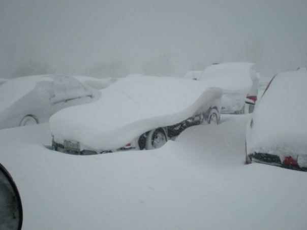
http://www.weathermatrix.net/2008/0220/rp220osw-1z.mov2. Buffalo finally got into the lake effect game a little bit this season. A bit of a disapointment that the official measurement only hit 4.2 inches, but still it helps out in catching up to Rochester. The lake effect was a bit of a suprise for us and played havoc for the local meteos in trying to forcast the lake effect comming off an 80% frozen lake. Snowfall totals picked up rather sharply just 2-3 miles south of the airport where a swath of 9-12 inches fell, about 6-8 inches of which fell in an intesne overnight burst lasting about 3 hours. Certainly not impressive for lake effect snow, but considering a single small hole in the ice managed to result in this still moderate and fairly well organized activity is interesting to note. Had the lake been ice free this would have been a perfect setup to dump a hefty amount of snow onto the Buffalo area. Things get more interesting now though hopefully I don't throw too much technical stuff I heard in too quickly. Since the lake was ice covered and not open water, the wind flow was actaully re-vectored shifting bands from where they would normally be expected. With the SW wind flow lake effect would normally setup in the city however the ice and wind convergenge actually resulted in bands and single convective cells to setup farther southward (more what you would see with a WSW-W wind flow) and then start to dance almost unpredictabily north and then south again. It also prevents a single band from gaining a prodomitie force comming off the lake and instead results in a multi-pronged feeder band effect which several times throughout the day kept merging into a single band then dying out in favor of more multi-bands. Another factor and something I learned from the NWS forcast discussion is that even if the lake is frozen lake effect, limited in nature of course, can still form if the conditions are right. I won't try and explain this in my own words, a copy and paste from the Buffalo forcast regarding the events off Lake Erie should sufice...
"THIS HAS BEEN A FACINATING EVENT TO WATCH UNFOLD. LAKE ERIE IS ABOUT 80 PERCENT ICE COVERED...HOWEVER IT IS STILL ABLE TO GENERATE SIGNIFICANT LAKE EFFECT SNOW. CONTRARY TO POPULAR BELIEF...ICE COVER DOES NOT SHUT OFF LAKE EFFECT SNOW. THERE ARE TWO CONTRIBUTIONS OF HEAT FROM THE LAKE...SENSIBLE HEAT FLUX AND LATENT HEAT FLUX. ICE COVER SHUTS OFF THE LATENT HEAT FLUX AS WATER CAN NO LONGER EVAPORATE...HOWEVER THERE IS STILL SIGNIFICANT SENSIBLE HEAT FLUX THROUGH THIN ICE COVER VIA CONDUCTION. AN ARCTIC AIRMASS SUCH AS THIS CAN STILL BE MODIFIED SUFFICIENTLY TO PRODUCE A CONDITIONALLY UNSTABLE BOUNDARY LAYER AND BANDS OF LAKE EFFECT SNOW DESPITE THE ICE COVER. THE AMOUNT OF OPEN WATER ON THE LAKE IS NOT NEARLY AS RELAVENT AS THE ICE THICKNESS...WHICH UNFORTUNATELY CANNOT BE MEASURED REMOTELY."So I guess even with a frozen Lake Erie Buffalo still has a running chance in the contest! As with the Lake Ontario band here is a radar loop from the Buffalo area. It highlights the 2nd band that effected the area later in the evening from around midnight through 9am.
http://www.weathermatrix.net/2008/0220/rp220buf-1.mov3. Well I thought my learning would have ended finding out decent lake effect could orgainze itself on a frozen lake, then this morning I was check radars around the Great Lakes region and I spotted this on the Grand Rapids, MI radar loop.
http://i32.photobucket.com/albums/d32/smadsen8486/2.gifThe strangest looking band of lake effect I have ever seen, looks like a mini hurricane doesnt it?! So I shoot off some message board questions to explain what I was seeing. It turned out to be a "meso-low" or small scale area of low pressure that can give lake effect band those visible traits on the radar. From what I was told they are not common occurances, yet they are not overally rare either. A local meteo in Buffalo told me that they tend to form with light winds in strong artic air masses. A few people in the Michigan area also commented that these meso-lows can often bring some intense squall conditions. If summerof41 from the forum is on maybe he can tell us how the conditions where this morning as the meso-low squall looks to have came inland right around his neck of the woods. Here is an extended 4 and 1/2 hour radar loop of the band where you can really see the circulation on the leading edge of the band and even circulating convection around the center.
http://www.weathermatrix.net/2008/0220/rp220grr1.movWhile I thought this was something rare to see it didn't take me long to hear from that another meso-low formed over Lake Huron not to long after the first one on Lake Michigan. Here is a close up of a much more defeined "eye" if you can call it that on what was dupped Hurricane Huron.
http://icons-pe.wunderground.com/data/wximagenew/m/MrSea/132.jpg?r=1203532488Lastly here is a loop of the satellite images that shows both of these meso-lows together, you do have to look really close to spot them! The one on Lake Michigan formed first and then a frame or two after you can spot the one on Huron briefly before it comes inland in Ontario.
http://i32.photobucket.com/albums/d32/smadsen8486/sat_ir_mw_loop-12.gif?t=12035737914. The Lunar Eclipse had a perfct skies here in the Buffalo area this evening. Certainly a fun sight to watch the moon being darkened and then turning red for about an hour and then just as quick going back to a white disc in the night sky. If anyone got any good pictures be sure to comment with a link or drop by the forum and share them with us! I was out snapping for a while but my camera probably didnt get anything good, I'll have to check them out tomorrow.
Well if you've made it all the way to the bottom of this post, thanks for being a die-hard reader! No snow dance and 4 big weather related happenings all in one day, go figure!


-769976.JPG)
-711237.JPG)
-746529.JPG)
-788768.JPG)
-741998.JPG)
-773021.JPG)
-709972.JPG)
-768671.JPG)


