


What a Wild Day
For all that hectic weather we paid for today my snow dance only looks to have droped a single inch of snow in the Buffalo bucket. Guess I still have a few things to work out with it.
Anyways a recap of the wild day today in Buffalo.
3am the temperature rises to 53 degrees.
4am the front with a weak squall line pass through the area.
5am the winds and artic air start blasting into the area. The temperature drops to 29 degrees at the 5am report (a 24 degree temperature drop in less than 2 hours).
6am the damaging winds begin a rapid increase acorss the area. Trees and power lines begin to fall.
7am the winds running the full length of Lake Erie cause the water level at Buffalo harbor to rise to 11.06 feet (3.06 feet) above flood stage. This is the 2nd highest flood stage ever recorded at Buffalo harbor and while records for the highest storm surge are not kept it is very likely this storm caused the most rapid rise in the lake level. An amazing 9.5 foot rise in the lake level in just a 2 hour period. This will lead to very rare flooding along the Niagara and Buffalo Rivers. (I'll expand a bit more below).
9am while the winds appear to start subsuding the lake effect snow bursts begin to organize into more definded feeder type bands and pick up in intensity despite the strong sheering winds and partially frozen Lake Erie.
10am the snow band keep cranking and the winds again increase. Sustained winds at the Buffalo Airport peak at 54 mph with a gust of 68 mph recorded. Many school net reporting stations record gusts in the mid to high 60's, with two reporting gusts in the 70's, and a station south of Buffalo (Starpoint) recording a gust of 81mph. As many as 60,000 customers in WNY are without power.
12pm the winds keep going strong in the 40-50 mph range. The lake effect is still cranking over the Buffalo area. The NYS thruway is shutdown from Buffalo to Rochester.
2pm the winds let up a bit into the 30-40mph range but the lake snows begin to start breaking up and moving a bit south of the area.
5pm, winds are down to 25-30mph and the lake snows are largely broken apart and south of the area.
8pm the NYS thruway reopens. Conditions have improved dramitcally with only patchy areas of difficult travel.
I've got to say this is probably one of the worst winter storms I have ever seen in my 22 years living in WNY. I was really expecting the NWS to issue Blizzard Warnings for a point late this morning but as bad as it was we just didnt hit the criteria and really the worst weather only last about 5 hours. This is probably the closest thing weve seen to a real blizzard since 1977. In my opinion the only thing that really didn't make this storm that bad was the lack of snowfall. We saw a good 4-6 hour period of really only moderate lake effect that seemed severe with the winds. But we had no snowpack to be blown around. Had we had a decent snowpack on the ground before this storm, or if the lake effect been more intense things would have certainly been much worse.
Probably the most interesting aspect to this storm was the lakeshore flash flooding. Now if there is anyone who knows the last time these events happened please let me know, I know it has happened before but it's been a long time since the Buffalo River flooded the old first ward of South Buffalo and the Niagara River spilled its banks along Grand Island, Tonawanada and Fort Erie in Canada. It was amazing to see how the rapid rise in the lake level caused the Buffalo River to back up and in a way reverse ice jam sending huge amounts of water backwards upstream. This backup even sent water rushing back into the feeder creeks of the Buffalo River and lead to a quick rise of 1-2 feet. Meanwhile along the Niagara River the winds and push of the water caused a great deal of ice to be forced over the ice boom that keeps the ice in Lake Erie and out of the Niagara River where it can cause damage to the power plants near Niagara Falls. The boom held up pretty good considering the conditions but still ended up being breached in at least two spots which lead to even more ice pouring into the Niagara River. This lead to even more rare flooding along the Tonawanda River Walks and homes and Marinas on Grand Island. Due to the location of the Niagara River sucking water from Lake Erie and then quickly pulling it over the falls, the level of the river is usually very slow to change and flash flooding conditions are a rare occurance. Seeing some of the pictures of the fishing peirs (which usually are 6-10 feet above the river level) completely underwater with floating ice chunks was unreal.
Here is a chart comparing the Buffalo Harbor water level to the Toledo water level this morning. Can certainly see where all the water came to and left from.
Here is a larger view of the CHART.
Now for some photos. Takes to long to upload all of them on here so I'll just link them.
Got to feel bad for this guy.
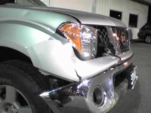
This car didn't make out much better either.
Flooding in Grand Island, so much for that nice river front property.
Flooding in South Buffalo's old First Ward came quickly flooding the streets and basements.
The riverwalk along the Erie Canal can't even be seen after the rise from Lake Erie poured into the canal.
A few of my damage pictures...
A construction trailer flipped on its side.
Two trees down on the same house. Luckily the car was spared!
Poor driving conditions!
ZERO visibility!
Ok enough about the storm. Things look to get interesting again in the next day or two with winter storm watches up. Snow/Sleet/Freezing Rain, a nice mix of everything is on tap!
posted by TheGeneral @ 11:38 PM
8 Comments
![]()
![]()


8 Comments:
Yesterday I watched with horror as the River came up even and then washed over our breakwalls turning our backyard into River coming closer and closer to the back door of my office and Family Room.
Substantial damage to the stones and breakwall at our River's edge is likely under what is today a super-olympic size ice rink that turns into crumply rammed piles of ice closer to the River's edge extending into an unmoving mass almost a mile across the whole River. It is unmoving at the surface. I have NEVER seen the River frozen over before. It looks like Lake Erie near the shore in February in a very cold year.
I worry that ice and water are likely to come higher up and do even further damage before this is over with the boom broken.
What strange environmental times we live in!
Barbara, I'm sorry to hear about your weather problems. With the new storm approaching I'm guessing that your area would probably rather see snow than rain although I'm not sure. Of course with the mess you described nothing would be the best but most likely that's not going to happen. Let's hope the water will subside before this next storm hits. Good luck to you!
General, that is a great post and I won't bump it down. Just to let you know the snow dance took place at 12:42 am this morning. I'll post more on the main blog later. Didn't you use to have some pictures of the boom so that people can kind of see what your talking about???
General, one more thing. The reason I did that snow dance last night was to try and pull this storm further to the East like Mike mentioned hoping that we can miss the freezing rain and potential rain by getting the temps to stay lower ;) Lets hope it works. After reading your post about the lake surge I'm wondering if you might not have performed the Tsunami dance by mistake :(
I have an off-topic question maybe someone here can find out for me:
What is the deal with the snowstorms in China that are paralyzing the country? (See story: http://www.nytimes.com/2008/02/01/world/asia/01china.html)
Everything I read about China does not say HOW MUCH snow they have gotten. Are we talking feet? Mere inches? Is this really bad snow or is it just a case of China not being used to any snow at all?
I come here for all my snow related intelligence, so I wonder if you guys have any information on this.
NYCO, from what I have read I think it comes down to is that China not use to that kind of snow or at least the places that got the snow. An article at http://ap.google.com/article/ALeqM5jvk7Cm_LiUKmk09LgSM7wXayDzlwD8UG5MJG1 from the AP mentions:
"Snow and ice storms in east, central and southern China — at no more than a foot of snow overall in some places — have overloaded businesses, the electricity grid and other systems that normally keep the economy ticking at double-digit rates. The weather was unusual for those regions, and they were ill-equipped to handle it"
It also quote a man that says they haven't seen that kind of snow in 30 years. Plus the extra traveling by the people for the Lunar New Years holiday most likely played a part in all those people being unable to get where they wanted to go. I guess one of the downfalls of a country that has that large of a population and relies so much on public transportation.
I haven't found anything yet as to exactly how much snow some of the areas received though other than what's above.
Starpoint is north of Buffalo (Pendleton)
final snow forecast: Albany .3 ,Bingo 2.2, syracuse 3.1, the rock, 6.3 , buffalo 5.4. this is through saturday morning and includes the back side of the storm when i believe rochester has the potential along with syracuse and maybe binghamton to pick up some additional accumulations.
Your blog keeps getting better and better! Your older articles are not as good as newer ones you have a lot more creativity and originality now keep it up!
Post a Comment
Subscribe to Post Comments [Atom]
<< Home